
Balch Springs Neighbors by Parcel
The defensible unit for a block check is a parcel edge. Start with a target address in the Dallas Central Appraisal District, then inspect adjoining parcels on the DCAD map and the city’s GIS resources. This approach records a repeatable geographic relationship. It does not promise a one-click neighbor result or identify every person near an address. Owner, occupant, mailing, voter, and association information are separate facts with their own restrictions.
| Source | What it can show about a block | Access and limit |
|---|---|---|
| DCAD Property Map | Target parcel, map position, and adjoining parcel context | Public map; export and buffer fields were not located |
| DCAD Property Search | Appraisal account, property address, owner/business result, value, and type | Current portal; it is not a title or occupancy record |
| Balch Springs GIS | Parcel, zoning, district, neighborhood, and street-map resources | City links; exact Parcel Locator fields were not exposed |
| Texas HOA certificate search | Association and certificate context in Dallas County | Certificate lead, not a member roster |
| City archive | Dockets, notices, maps, budgets, and project records tied to a subject or date | Keyword and date-range search; no universal resident roll |
DCAD says an account number is the best key. Its address search can also lead to the result when the number, direction, street name, city, and other fields are normalized. A recorded owner may be an entity, trust, estate, or absent owner. That is why the result should be written as a parcel or recorded-interest finding, not a statement about who lives there.
Balch Springs Map Edges
Map adjacency deserves a second check at the city limit or a subdivision edge. Balch Springs GIS links to parcel, zoning, neighborhood, council-district, precinct, future-land-use, street, and transportation resources. The city directs other data needs through Open Records. The DCAD property map accepts an account, property address, owner name, or map click. Its captured materials did not expose a neighbor-list export, a buffer distance, ownership-history display, or a complete layer inventory, so none should be assumed.
The city’s zoning ordinance explains why a block line can be less obvious than it looks on screen. Official zoning boundaries generally follow streets, alleys, property lines, or their extensions. When a line runs approximately along a street or alley centerline, the centerline controls. Annexation and zoning are separate. These rules help interpret planning geography, but they do not establish legal boundaries, physical presence, or a relationship between people.
Note: Check the parcel’s legal description and current map context whenever an apparent neighbor sits near a city, ZIP, or subdivision edge.
Mapping a Balch Springs Block
A short parcel workflow keeps a block search tied to official geography. Record the source date and the account number, not a collection of sensitive personal details. Move from the address to the parcel, then from the parcel to any documented instrument or civic record. A full named-street history requires a different research path.
- Enter the target address in DCAD and preserve its normalized spelling, city, and account number.
- Open the map result and identify parcels that share an edge, face the address, or are separated by a street.
- Use the account and legal-description context to check a relevant recorded instrument or plat, without treating the result as occupancy proof.
- Use city GIS, zoning, or a dated public notice only when it answers a defined geographic or civic question about the block.
For a complete chain along a named road, use the Balch Springs street directory route. It follows address-keyed property and deed research beyond the immediate block. Here, the useful flow is address → DCAD account → map edge → legal description or instrument → carefully scoped city or association context.
Balch Springs Association Records
Texas HOA management-certificate results can provide civic context around a parcel or neighborhood name. They do not provide a roster of households. The Dallas County results located for Balch Springs should be checked against the live certificate, its date, manager, city, ZIP, and governing documents before they are used. The entries below are association-name leads from that state search, not an assertion about membership or residence.
| Spring Ridge HOA | Balch Springs certificate-search result; verify the certificate before relying on its current details. |
|---|---|
| SL Homeowners’ Association Inc. | Result identified with Springlake context; an association name is not a resident list. |
| Pioneer Bluffs HOA Inc. | Useful as a map and certificate search term for a defined community area. |
| Canyon Ridge of Balch Springs HOA | Certificate-search lead that requires a live document and date check. |
| McKenzie Trails Residential Community Inc. | Listed with ZIP 75182, an unverified edge-data lead rather than a standard city ZIP conclusion. |
| P Bluffs Homeowners Association Inc. | Returned with the source spelling “Baulch Springs,” preserved as an index quirk. |
“Baulch Springs” is a source-data spelling, not a corrected city name. When the expected city filter fails, try that spelling and inspect the underlying certificate. Preserve the spelling in a research note instead of silently normalizing it. The same care helps with old locality names, street abbreviations, and OCR errors in historical material.
Balch Springs Neighborhood Map Names
The Balch Springs 2050 plan, adopted in 2024 according to city materials, names Oaks, Pioneer Oaks, Spring Oaks, Heritage Park, Pioneer Bluffs, and Rose Gardens. Those are useful terms for finding planning documents, maps, public notices, and association certificates. They are not proof that any specific person belongs to a neighborhood or resides at a particular address.
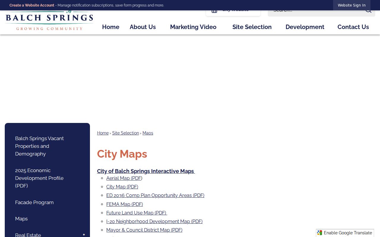
For map context, the Balch Springs EDC maps collection includes city, aerial, FEMA, future land-use, neighborhood-value, I-20 development, and zoning materials. It supplies a visual way to compare a block with planning layers without converting the map into a people list.
The Balch Springs EDC map collection is the source for this map-reference view.
Balch Springs Block Record Choices
Official records and commercial neighbor-search products do different things. An official map or appraisal result states its keeper and has a defined purpose. A commercial category may combine older, incomplete, or unexplained data. For a parcel question, use the map, appraisal account, recorded instrument, or a narrowly described government request. For a historical question, use a dated directory image or archive item and label it as historical.
| Research route | Best use | What to avoid assuming |
|---|---|---|
| Official parcel and GIS records | Map position, account context, and planning geography | That an owner entry identifies every occupant |
| County recorded instruments | Party roles, document dates, and legal descriptions | That a recorded interest proves current presence |
| Dated archive or directory material | Historical civic or address context | That a past entry describes the present |
| Commercial neighbor-search category | At most, a lead to check with an official keeper | Its completeness, date, identity matching, or lawful relevance |
Balch Springs City Record Requests
For a specific city record that is not indexed, start with the City Secretary and the Texas Public Information Act. The city archive includes court dockets, public notices, finance records, redistricting maps, budgets, newsletters, and project categories. Search by a defined term, category, and date range before requesting a record. Texas Government Code chapter 552 calls for a reasonably specific description to the governmental body that holds it.
The Balch Springs Code Enforcement page permits anonymous reports and warns that a reporter’s name or phone number becomes public record when supplied. No city name-search interface for code cases was located in the research. Request only a specific lawful record and protect reporter information. The city’s open-records route is the fallback when a targeted item cannot be found online.
For a block issue, the archive’s category list provides useful limits on the request. It includes the Balch Springs Hickory Tree Road Project, Court Dockets, EDC Newsletters, 2021 Redistricting Maps, audits, financial budgets, public notices, and municipal-court weekly dockets. Those categories can establish that a dated city item exists or help identify its custodian. They do not establish a neighborhood roster. The Request Tracker covers service categories such as code enforcement, streets, water or sewer work, parks, and litter or debris, but its public page did not expose a complete searchable person field or a retention period.
The Balch Springs Municipal Court is another distinct route for city and state-ordinance Class C fine-only matters. The court page identifies citation forms and court-date, deferred-disposition, driving-safety-course, payment-plan, and attorney or surety-bond forms. A citation response is due within 20 calendar days, and calls do not constitute an appearance. Use a case or citation number with the court rather than treating a public docket mention as a complete history.
Balch Springs Neighbor Lookup Limits
Parcel ownership and physical presence are different facts. Texas voter information has confidential-address and identity limits. Court and vital records can be sealed, restricted, or available only through an eligibility process. The Texas Address Confidentiality Program protects eligible participants with a substitute-address system. Do not seek to defeat that protection through maps, voter data, association records, or cross-referenced searches. Utility and delivery data are not a public block directory.
Lawful use. Use Balch Springs parcel and civic records for lawful neighborhood, family, historical, or safety research. Do not use any result to stalk, watch, harass, intimidate, or harm another person.
Save the parcel account, instrument number, source URL, date, and access limit in the research log. Those details make a block question reproducible while minimizing names and sensitive information. A map edge is a geographic starting point, not a personal dossier.